|
Presque Isle State Park Bikepath |
one moment while we fetch a trail picture
|
|
|
Presque Isle State Park Bikepath |
one moment while we fetch a trail picture
|
| Location | Presque Isle State Park, Erie County | ||
| Trailheads | Presque Isle, Ridge Center | ||
| Length, Surface | 13.3 miles total (7.3 paved, 5.0 bike lane) | ||
| Character | Busy, state park, mostly shady, flat | ||
| Usage restrictions | No motorized vehicles, no horses | ||
| Amenities | Rest rooms, water, bike rental, food, lodging | ||
| Driving time from Pittsburgh | 2 hours 4 minutes |
Near the waterworks, at mile 2.3, the trail passes the ferry dock. A water taxi runs from here to the Erie Bayfront. In 2018 it operates May through the end of September. The water taxi accepts bicycles (porterie.org/watertaxi). A quarter-mile farther on the right is the side road to West Pier and the Marina.
At mile 3.9, the trail crosses to the north side of the main road and a connector spur joins from inland. The main trail goes right/northwest to continue along the road. The spur straight ahead connects to the other side of the loop. It could be used to shorten the ride around the peninsula or to return to this point after riding the outer part of the loop. From here the main trail is one-way, designated to be ridden counter clockwise, because the bike lane on part of the loop is only on one side of the road and the last mile of road is one-way. The trail remains on the inland side of the road for most of a mile, offering views of the ponds and marsh that form the interior of the peninsula. The trail crosses the road again at the intersection with the Long Pond hiking trail and continues about half a mile to Perry Monument, 5.7 miles from the park entrance. This is the designated starting point of the Erie to Pittsburgh Trail, which goes back to the entrance and joins bike lanes on the road.
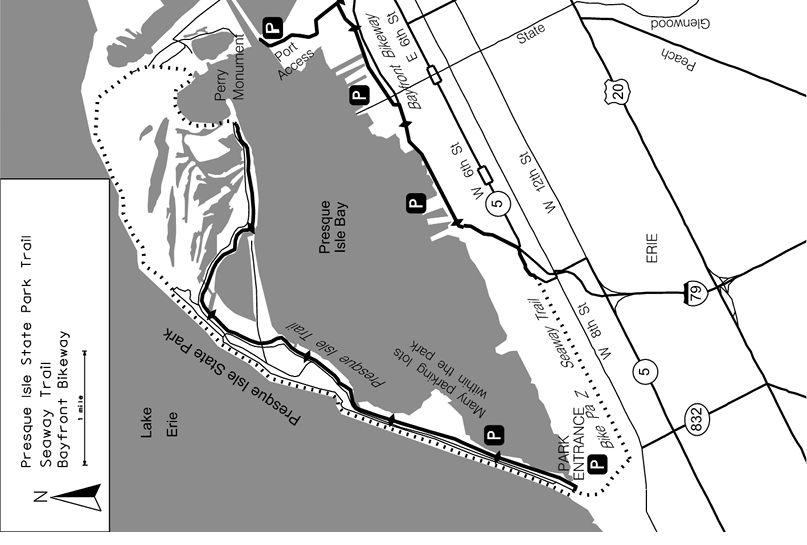
At Perry Monument the trail becomes a designated bike lane 8-foot wide and follows the road around to the less wind protected north shore on the lake. Only the lake side of the road has a bike lane. Here woods alternate with sand dunes and beaches that offer the only surf swimming in Pennsylvania. The same winds that create the surf and dunes may also drift sand into the bike lane.
Near Ainsworth Beach (mile 9.3), the other end of the connector spur turns left/east on a side road, then heads off through the woods for 0.3 miles to the bay side where the outbound trail forked.
Continuing on the shore road (rather than the connector spur), the trail stays close to beach access and parking lots. Shortly after passing the Rotary Pavilion (mile 10.5), the trail swings away into the woods (mile 10.7). At the northeast end of Old Lake Rd (mile 11.4) the entire road is dedicated to the bike trail until it reaches the interpretive center (mile 12.4). At that point Old Lake Rd is shared between a one-way motor traffic lane and a bike lane until the southwest end of Old Lake Rd, where it becomes a narrow bike lane along the main park road back to the entrance (mile 13.3). This one mile section is why the trail is designated as one way.
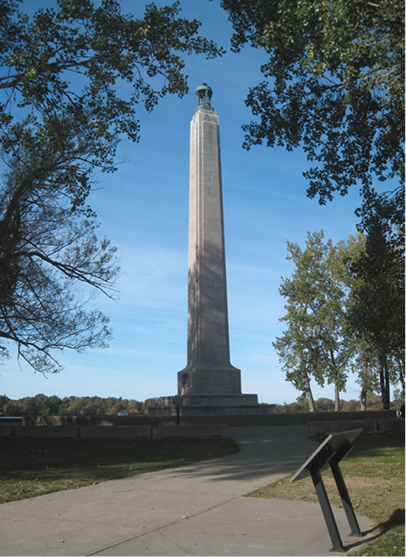
Perry Monument
Presque Isle State Park Bikepath - Oldest segment segment check 2015-Oct This page brought to you by the book